 Of the countless ways Arlington supports the daily lives of its residents, businesses and visitors, the ease of driving on the roads and streets of the city ranks high on the list of expectations that most of us have when it comes to getting around in town.
We want our daily commute to be as smooth as possible, considering all the challenges we must navigate among the presence of uncountable vehicles we encounter almost everywhere we travel.
In addition to all the means of managing traffic flow to keep things safe, we want nice street surfaces and the least congestion possible for us to have to deal with.
To produce that desirable result, we become aware of the challenge the city faces when responding to our wants and needs on the road.
Some streets and intersections don’t seem wide enough, and we hate it when our tires encounter potholes, deteriorated pavement and other rough conditions as we move about.
We wonder when streets are going to be repaired or rebuilt, and then we wonder again when all the road work we encounter is going to be finished. It seems an endless cycle, and, of course, it is.
In response to these questions and concerns, Arlington has produced a quite remarkable way for us to find answers and it’s as close as our nearest electronic device. If you haven’t discovered it, read on and take a look. I think you will like what you see.
It begins with a trip to one of the city’s websites – this one can be immediately found via Google by entering “Arlington street tracker” in the search box.
There you will first find a projects list. Currently, there are no less than 103 ongoing tasks involving the city’s street network. Each comes with a short explanation of what is being done or planned.
Next is a tab showing any street closures (thankfully, there aren’t many) showing dates and a pretty thorough explanation of what’s going on with each of them and a phone number and person to call to address your questions.
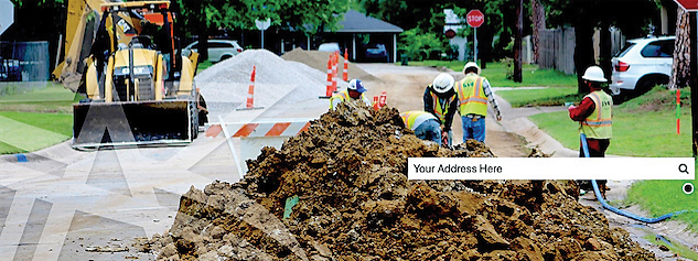
Then take a look at the street tracker map that provides residents, businesses and visitors with an immediate understanding of current construction projects and project points of contact. The map is search-able, and you can enter your own address to see what is going on around you.
Concerned about street conditions and how the city uses a grading system for streets based on the overall condition index? The system, which includes every street throughout the entirety of the city’s 99 square miles, allows for appropriate prioritizing of streets for reclamation or rebuild and a more accurate cost estimation and budget forecasting.
That brings us to a realization of the cost of all this street work. It’s a lot. But almost all of it is in response to what voters said they wanted. It happens in two ways. First, there are the regular bond programs put before voters, and the street work is always the largest item on the ballot.
Second, voters have authorized a quarter cent sales tax devoted to building and repairing our roads. Since the inception of this funding source, approximately $200 million has been invested in the city’s never-ending street work.
In both of these cases, very large majorities of voters who see this need to be a priority have consistently over the years set it all into motion.
That takes us to the remaining tab on the website – the bond tracker. There you will find a summary of the most recent bond programs and how such voter-approved borrowings are rated by the nation’s agencies that track cities financial performance.
Arlington shines in these evaluations by carrying some of the highest scores of cities across the country.
Finally, there’s an opportunity to report a street problem. Things like ponding areas, street light issues, sign requests, view obstructions, and, the most popular of them all, a link and phone number to report a pothole.
That’s something the city is doing at a record pace of 10 or more per day that has led to more than 8,000 potholes being filled since the program began. Requests are often addressed on the same day, and all calls can expect results in no more than three days.
I’ve run out of space. There’s lots more on the city’s website. In addition to the Google search mentioned earlier, you can enter “street tracker” in that website’s search box.
Richard Greene served as Arlington’s mayor from 1987-1997 and currently teaches in UT Arlington’s graduate program in the College of Architecture, Planning and Public Affairs.


